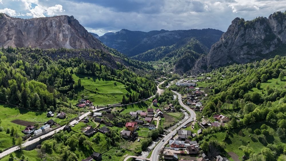
Top 30+ mountain trails in Romania and how to prepare for an unforgettable vacation

Want to enjoy an active vacation in the mountains of Romania? Hiking in the mountains can be an ideal choice to recharge your batteries, recharge your energy, and relax after a busy period at work.
Here is a list of mountain trails in Romania that you can explore, as well as some practical recommendations for a successful vacation.
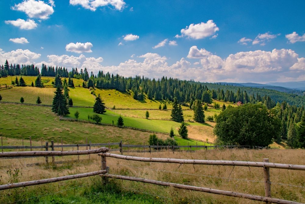
A short introduction about the country’s mountain areas
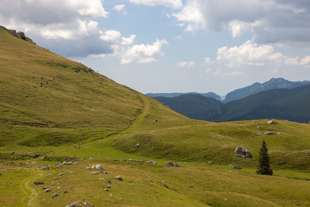
Whether you’re traveling with your family, as a couple, in the company of friends or on your own, whether you’re a beginner or an experienced mountaineer, you’re sure to find tourist routes in Romania to suit your needs and to delight your eyes. As a rule, mountain areas in Romania are divided according to mountain groups.
Which are the mountain areas in Romania?
Here are the most beautiful tourist trails in Romania, with easy access by car at the base of the trail:
- Bucegi – Leaota – drive from Bucharest to Sinaia, Bușteni, or Azuga, where the trail starts;
- Ceahlău – drive from Bucharest to point Y, where the trail starts;
- Făgăraș – Iezer – Păpușa – drive from Bucharest to Izvorul Muntelui, Bicaz or Piatra Neamț, where the trail starts;
- Măcin – drive from Bucharest to the commune of Măcin or Greci, where the trail starts;
- Retezat – drive from Bucharest to Cârnic or Nucșoara, where the trail starts;
- Rodnei – drive from Bucharest to Romuli commune, where the trail starts;
- Metaliferi – drive from Bucharest to Peștera lui Avram Iancu (near Badai), where the trail starts;
- Buzăului – drive from Bucharest to Crasna commune, where the trail starts.
Top mountain trails in Romania by difficulty
The difficulty of a route is very important to keep in mind when planning a hike. Here is a ranking of mountain trails in Romania according to difficulty:
- Easy mountain trails
- Sinaia – Poiana Stânii
- Ghețar Village – Scărișoara Cave
- Pricopan Peak
- Mountain trails medium difficulty
- Bușteni – Diham Hut
- Azuga – Șaua Baiului
- La Șipote – Glăjăriei Valley
- Mountain trails hard difficulty
- Bădeni – Leaota Peak
- Rotunda Pass – Șetref Pass
- Arefu – Podeanu Peak
It is said that the most difficult mountain route in Romania is crossing the Făgăraș Mountains from east to west. On the list of the most difficult mountain trails in Romania are also Vârful Șerbota – Șaua Cleopatrei (very rugged route with jagged ridges), Creasta Pietrei Craiului, Vârful Vânturarița Mare – Curmătura Oale, La Trei Pași de Moarte (between Fereastra Zmeilor and Vârful Arpașu), Vârful Moldoveanu (2. 544 m), Vârful Negoiu (2.535 m), Vârful Viștea Mare (2.527 m), Vârful Parângul Mare (2.519 m), Vârful Lespezi (2.517 m).
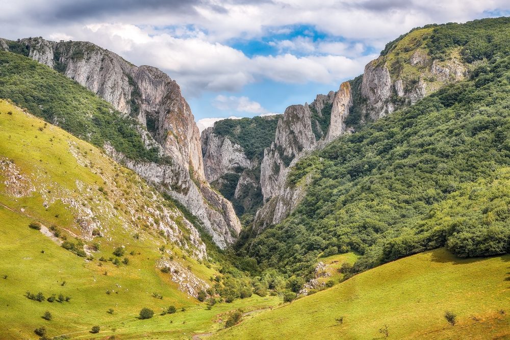
The most beautiful mountain trails in Romania
The most beautiful mountain trails in Romania lie between the sky and the earth, where the air is cleaner and the silence is deep. These beautiful trails, which offer great views, are an invitation to connect with yourself and the surrounding world. Here are the most beautiful mountain trails in Romania:
- Trails from the Bucegi Mountains to the Howler Waterfall – the trails delight with spectacular mountain views, impressive cliffs, deep valleys and dense forests. The Howler Waterfall gives a magical atmosphere to the place and creates a unique experience;
- Trails from the Bihor area to the caves (especially the Bear Cave) – you will be delighted by the rich biodiversity as well as the caves along the way. The latter can be opportunities to enjoy what nature has left, as well as to explore the depths;
- Transylvanian mountain trails (Grohotiș Peak, Suhardul Mic, Tarnița, Iezer, etc.) – delight in their diversity. You will pass through deciduous and coniferous forests, alpine meadows and rocky ridges. Along the trails you can discover authentic Saxon villages, old wooden houses and fortified churches;
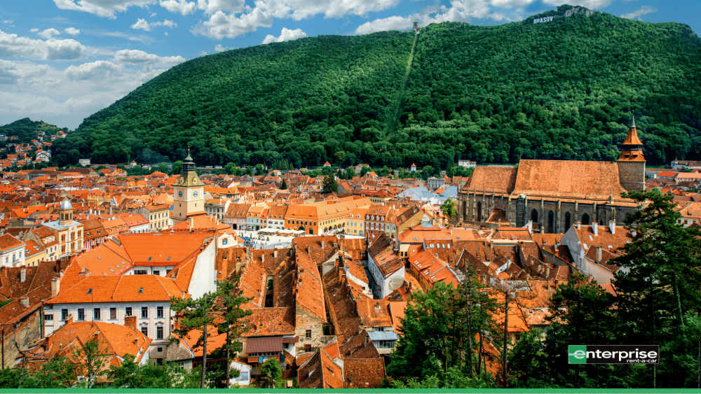
- The trails around Brasov – Tâmpa Mountain offer a 360-degree overview of the city, while Piatra Craiului surprises with its sharp ridges, vertical walls and wild landscapes.
Top mountain trails near Bucharest
Want to go hiking, but don’t have much time. Try one of the mountain trails near Bucharest. Here are some of them:
- Sinaia – Franz Joseph Cliffs – offers great views of the Bucegi Mountains and takes you through a conifer forest. The Franz Joseph Cliffs are a unique geological formation. In addition, the trail is easily accessible, so it can also be done by families;
- Azuga – Baiului Ridge – the trail offers spectacular views of the valleys, distant villages and neighboring ridges. Rocky areas alternate with alpine meadows and coniferous forests. The trail also combines gentle sections with bumpy sections for a complete experience;
- Zănoaga – Scropoasa Lake – is well marked and easy to follow, even for beginners. Forests, meadows and Scropoasa Lake are all the more reasons to come. Close to the lake you can visit the 7 Springs Waterfall, another attraction in the area.
Top 30+ mountain trails in Romania to enjoy no matter your age
The Carpathian Mountains reveal a wealth of breathtaking mountain scenery, inviting you to explore forest roads, trails and rugged peaks. In this top tourist trails in Romania, we’ll set off on a journey through the country’s most spectacular mountain trails, discovering treasures and creating unforgettable memories. Here are some light mountain trails, medium mountain trails and heavy mountain trails, grouped according to the mountains they belong to.
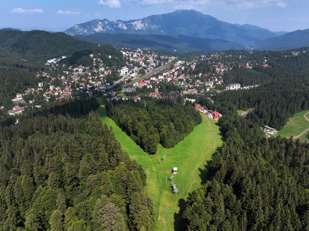
Mountain hiking in the Bucegi Mountains
The Bucegi Mountains are located in the east of the Southern Carpathians and include over 100 mountain trails. They vary in difficulty. There are mountain trails for beginners, for people in good physical condition and difficult trails for experienced people. Depending on this, there are both one-day mountain trails (such as the Prahova Valley mountain trails) and multi-day trails that may require camping. See below for some mountain trails in the Bucegi Mountains.
1. Bușteni – Howler Waterfall
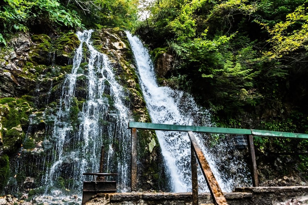
- Difficulty level: easy
- Distance: 3,59 km
- Walking time: 1h 30 min
- From where to where the route stretches from: Bușteni – Howler Waterfall
- Accommodation options: hotel/pension/cabin in Bușteni
This hike is part of the Bucegi easy trails. The trail takes you fairly smoothly between the resort of Bușteni and the waterfall. The trail starts at the end of Telecabinei street, from where the trails to Jepii Mari and Mici start.
You can reach the cable car station by car and leave it in the nearby parking lot. The trail continues on the paved road, along the river and following the tourist markers (red dot, blue triangle and blue cross). The path is flat and not difficult.
However, it crosses some slightly slippery wooden bridges, which is why you need to be careful, especially on rainy days when mud is also forming. Good grip footwear is recommended, as well as a Bucegi trails map, as there are several roads in the area and you can easily get lost.
You can easily reach the base of the trail by car, if you are coming from Bucharest on the A3 highway, direction Bucharest – Ploiești – Breaza – Breaza – Sinaia – Bușteni.
👉 For added convenience, rent a car from Enterprise Romania. And for more useful information and travel ideas, follow us on social media and TAG us photos from your road trips.
2. Predeal – Azuga
- Difficulty level: medium
- Distance: 9,5 km
- Walking time: 6h
- From where to where the route stretches: Predeal – Clăbucet slope – Gârbova hut – under Clăbucetul Taurului – Azuga
- Accommodation options: hostels, hotels, lodging in Azuga
A mountain route between Predeal and Azuga can be a great experience, whatever the season. In the resort of Predeal, take the left side of the slope. Walk up the path to the ski lift station, then enter the forest on the right side.
The path takes you gently up to the Gârbova Hut, then under the Clăbucetul Taurului, through the forest. Descend to the right on the western side of the Clăbucetului Taurului until you reach a long glen. From here, you can turn left and quickly reach the town of Azuga. From the clearing, the trail descends into the Prahova Valley.
You can easily reach the resort of Predeal and the base of the route by following the A3 from Bucharest, then the DN1, Bucharest – Ploiești – Comarnic – Sinaia – Bușteni – Predeal.
3. Gura Diham Circuit
- Difficulty level: medium
- Distance: 17,09 km
- Walking time: 6 h 15 min
- From where to where the route stretches: Gura Diham Hut – Poiana Izvoarelor Hut – Mălăiești Hut – Diham Hut – Gura Diham Hut
- Accommodation options: hostels, hotels, cabins in Bușteni
One of the most spectacular mountain trails in Romania is the Diham Circuit in the resort of Busteni. You can reach the Diham Hut by car, the road is paved and easy to drive on. It is about 5 km from Busteni.
From Gura Diham, follow the red lane until Poiana Pichetul Roșu. From here, you follow the red triangle to Cabana Mălăiești, and from here, follow the blue lane to the tourist signpost. Here it will change to a blue cross until you reach Diham Hut. You can take a rest stop, then follow the red dot marker, and then the yellow triangle to Stâna Șaua Baiului. From here, the road takes you to the Gura Diham Hut.
You can easily reach the base of the trail by car on the A3, then on the DN1, departing from Bucharest, in the direction Bucharest – Ploiești – Comarnic – Sinaia – Bușteni – Cabana Gura Diham.
4. Bușteni – Mălăiești
- Difficulty level: medium
- Distance: 12,24 km
- Walking time: 5h
- From where to where the route stretches: Bușteni – Căminul Alpin – Poiana Coștilei – Poiana Pichetul Roșu – La Prepeleac – Cabana Mălăiești
- Accommodation options: hostels, hotels or huts in Bușteni
The road up to Mălăiești is no longer classified for the top easy trails Bușteni. Therefore, you need to know in advance that you need to be in very good physical condition and equipment suitable for the weather conditions.
The trail starts from the resort of Bușteni, on Morarului street, up to the Căminul Alpin. Continue along the path, on the Munticelu Plain, and then the Gălbenelelor Valley and Poiana Coștilei. Go through the forest on the level curve with gentle climbs and you reach the Poiana Pichetul Roșu. The trail continues to Poiana Bucșoiului and the grassy spur below the eastern flank of Vârf Bușcoiu. The trail continues with wooden bridges and chains on the Șaua Mălăiești (1,780 m). After crossing a rocky step, you reach the Mălăiești Hut.
You can reach the resort of Bușteni quite easily by car by following the A3 highway from Bucharest, then Ploiești – Comarnic – Sinaia – Bușteni.
👉 If you’re going on vacation with the family, you can also stop by one of the adventure parks in the country. See a top 5 adventure parks in Romania, perfect for big and little ones.
5. Bran – Omu Peak
- Difficulty level: medium/hard
- Distance: 13,12 km
- Walking time: 7 h 30 min
- From where to where the route stretches: Bran – Poiana Ciubotei – Scara Peak – Omu Hut
- Accommodation options: hostels in Bran
The route Bran – Omu Peak is one of the most popular mountain trails in Romania and takes you to one of the highest peaks 2.505 m (Vf. Omu). It is a route with a medium to difficult difficulty level and requires excellent physical condition as well as knowledge of the mountains or a mountain guide.
It starts from the resort of Bran and goes through the village of Poarta, then through the Ciubotea Valley and the mountain rescue base. Follow a long and steep path and a glacial caldera. Climb up the Ciubotea ridge and pass over rocky steps below Scara Peak. You go down the western slope of Mount Scara to the Horns’ saddle. Continue the ascent for another 45 minutes to the Omu Hut, located at an altitude of 2,505 meters. The route is inaccessible in winter.
If you leave Bucharest by car, you’ll arrive in about 3 hours on the A3, then on the DN1, on the Bucharest – Ploiești – Comarnic – Sinaia – Bușteni – Azuga – Râșnov – Bran route.
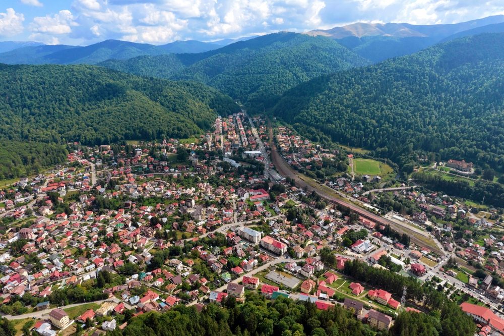
Mountain trails in Sinaia
Only 1-2 days for mountain hiking? You can try one of the easy trails in Sinaia. Find out more below.
6. Sinaia – Poiana Stânii
- Difficulty level: easy
- Distance: 5,04 km
- Walking time: 2 h 15 min
- From where to where the route stretches: Sinaia – Dimitrie Ghica Park – Sinaia Monastery – Furnica – Ski Hut – Stâna Regală
- Accommodation options: hotel, guesthouses or cottages in Sinaia
Another easy mountain trail is Sinaia – Poiana Stânii. You can complete the scenic route with a canyoning experience in Dâmbovicioara. The trail starts from the entrance of Dimitrie Ghica Park and continues past the Sinaia Monastery, where the blue band marking becomes visible. You will follow this marker until Stâna Regală (route Furnica – Cabana Schiorilor).
After another 10 minutes on the paved path (Poteca Regală) you reach Poiana Stânii. There are some branches along the way, but it is advisable to follow the signposts, especially if you are following the mountain trail for the first time. It can be done all year round, but there can be difficulties in winter.
If you choose to drive to the entrance to the Royal Path, you’ll save about half the walk. It’s easy to get to the entrance on the A3, then the DN1, Bucharest – Ploiești – Breaza – Sinaia.
7. Sinaia – Cabana Padina
- Difficulty level: medium/hard
- Distance: 14,14 km
- Walking time: 6-7 h
- From where to where the route stretches: Sinaia – Hotel Cota 1400 – Șaua Vârfului cu Dor – Valea Izvorul Dorului – Șaua Lăptici – Cabana Padina
- Accommodation options: hotel, guesthouses or cottages in Sinaia
The route starts from the Dimitrie Ghica Park in Sinaia. Once you reach the Pelișor roundabout, you’ll climb through the houses to cut through the winding path to the Valea cu Brazi Hut (1,500m above sea level). If you come in winter, follow the winding path. The trail continues up to the Vârful cu Dor hut and the Vârful cu Dor saddle. The trail starts going down the Valea Soarelui slope, then you reach the Șaua Lăptici, cross the road leading to the hotel, cross a wide glen, and a little uphill to the right, you reach the Cabana Padina.
You can get to Sinaia by car from the A3, then take the DN1 in the direction Bucharest – Ploiești – Breaza – Sinaia.
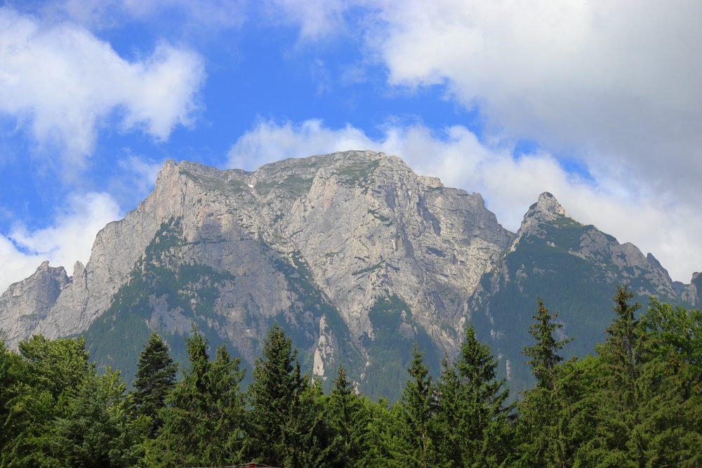
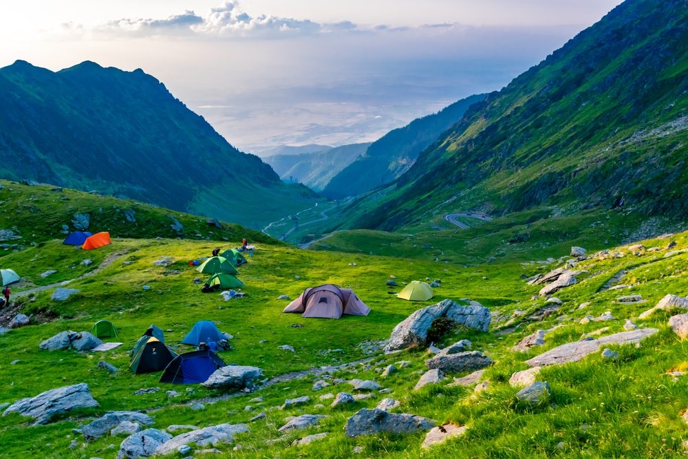
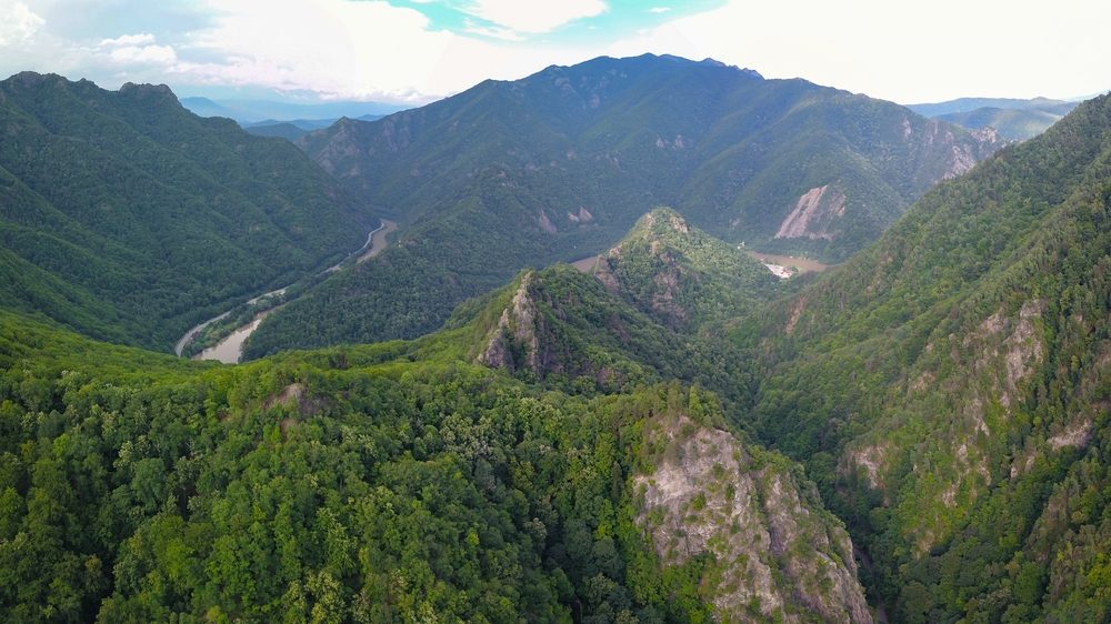
Mountain trails in the Făgăraș Mountains
The Făgăraș Mountains are sought after by people looking for adventurous vacations and adrenaline-packed mountain trails. The glacial terrain, high altitudes and challenging trails attract many tourists. See below some of the most beautiful mountain landscapes in Romania and the Făgăraș Mountains.
8. Sebeșu de Sus – Cabana Suru
- Difficulty level: medium
- Distance: 8,5 km
- Walking time: 4 h
- From where to where the route stretches: Sebeșu de Sus – Valea Moașei – Cabana Suru
- Accommodation options: hostels in Cabana Suru, Joseni or Porumbacu de Sus
The route starts from Sebeșu de Sus and goes along a forest road on the Moașei Valley (a bridge points to this valley). The road goes smoothly for 1,5 hours, then you reach a path and you will walk through the forest. At first you’ll walk on the west side, then the east. Along the valley, you will encounter several waterfalls. The climb continues steeply uphill, winding up to a wide glen and a hut. Turn east and enter the forest again. You’ll climb steeply to the southeast, and then you reach the back of the Suru Hut.
To get to Sebeșu de Sus, you will have to take the A3, then the E68 in the direction of Bucharest – Ploiești – Comarnic – Sinaia – Bușteni – Azuga – Râșnov – Făgăraș – Avrig – Sebeșu de Sus. Once in the village, follow the signs to enter the route.
9. Avrig – Cabana Barcaciu
- Difficulty level: difficult
- Distance: 25,01 km
- Walking time: 7-10 h
- From where to where the route stretches: Avrig – Avrigului valley – Poiana Neamțului hut – Bârcaciu hut – Bârcaciu mountain – main ridge
- Accommodation options: locality Avrig, guesthouse
The trail that connects the town of Avrig to Barcaciu Hut is one of increased difficulty, which is why it is recommended only for people in excellent physical condition and with mountain training; it is one of the most difficult mountain trails in Romania. If you’re a mountain biking enthusiast, this route is also suitable for cycle touring. At the end of the trail you will have a great view of the peaks of Ciortea and Scara.
To get to Avrig by car, follow the A3, then the DN73A and DJ105F, on the route Bucharest – Ploiești – Comarnic – Sinaia – Bușteni – Azuga – Râșnov – Făgăraș – Avrig.
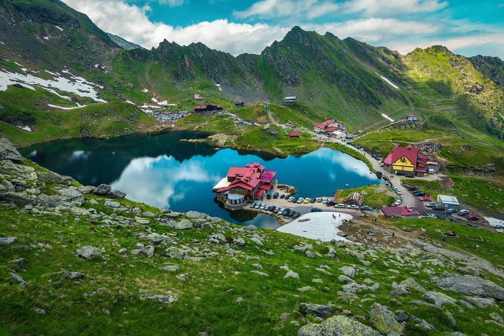
10. Lacul Bâlea – Șaua Capra
- Difficulty level: medium
- Distance: 0,7 km
- Walking time: 1 h
- From where to where the trail goes: Lake Bâlea – Capra saddle
- Accommodation options: cottages or hostels in Curtea de Argeș, the communes of Cumpăna, Valea Danului, Arefu etc.
If you want to have a great view of the Transfăgărășan road, follow the Lacul Bâlea – Șaua Capra route. Although it only takes an hour, the steep climb indicates that the route is not for beginners. From the northeastern end of the horse near the hut, head north (left) from the rocky ledge and up the path and serpentines until you reach the Șaua Capra. If you still have the energy, you can descend into the bucket below the saddle to see Goat Lake and Deer Lake.
You can easily reach the Transfăgărășan by car on the E81, then the DN7C, Bucharest – Ciorogârla – Pitești – Curtea de Argeș – Corbeni – Bâlea Lac.
11. Piscul Negru – Vârful Negoiu
- Difficulty level: medium/hard
- Distance: 14,28 km
- Walking time: 11-12h
- From where to where the route stretches: Piscul Negru Tourist Complex – Călțun Lake – Vf. Negoiu – Vf. Lespezi – Piscul Negru
- Accommodation options: hostels, huts, hotels Transfăgărășan
Also close to the Transfăgărășan is another spectacular route, connecting Piscul Negru and Vârful Negoiu. Because the slopes are steep and reach heights of over 2,500 meters, the route is considered medium to difficult. You walk on forest roads, through glades and glacial meadows.
To get to the Transfăgărășan from Bucharest, follow the E81, then the DN7C, in the direction of Bucharest – Ciorogârla – Pitești – Curtea de Argeș – Corbeni – Piscul Negru.
12. Breaza – Vf. Urlea
- Difficulty level: medium
- Distance: 7,48 km
- Walking time: 4h
- From where to where the route stretches: Breaza – Pojorta Valley – former Urlea Hut
- Accommodation options: hotel, cottages, hostels in Breaza
The route Breaza – Vf. Urlea is famous, especially for the animals that can be observed in the natural habitat. The trail of medium difficulty starts from the locality of Breaza on paths, winding paths and valleys with a lot of vegetation. It is dangerous in winter because of the risk of avalanches.
You can get there from Bucharest by car on the A3, Bucharest – Ploiești – Breaza.
👉 You can get a €25 discount on your next car rental if you subscribe to the Enterprise Romania newsletter.
Mountain trails in the Retezat Mountains
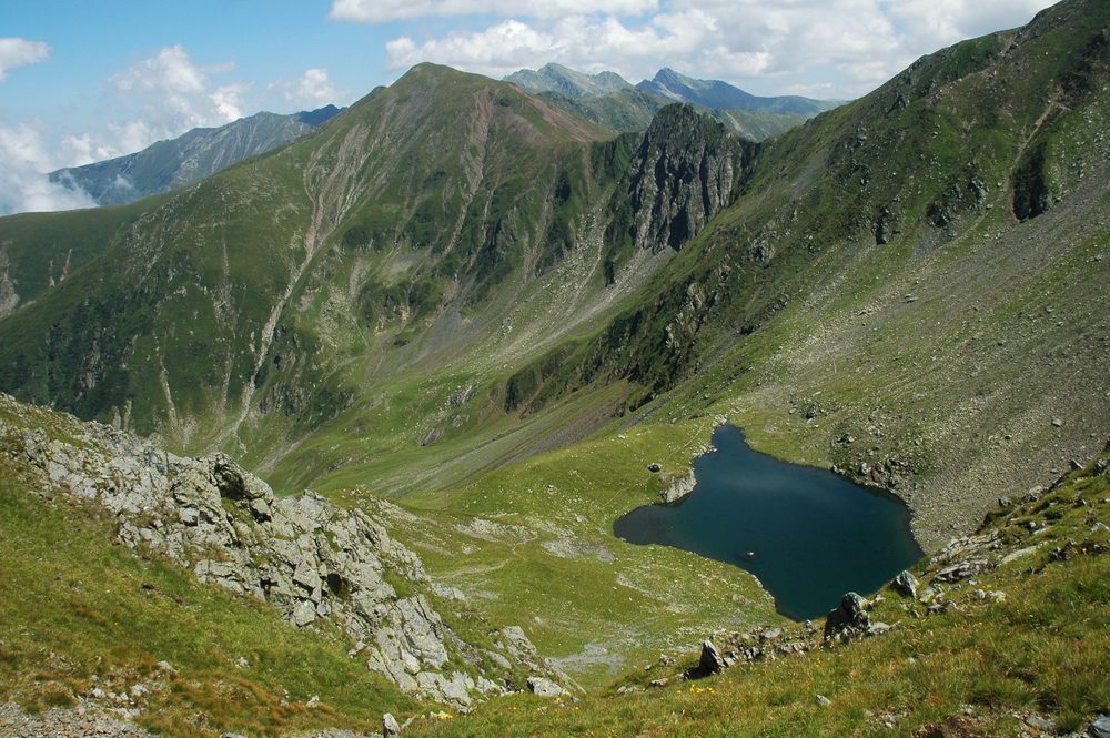
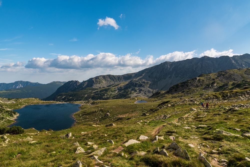
The Retezat Mountains are part of the Retezat-Godeanu mountain group, with the highest peak, Peleaga, 2,509 meters. Many people hike Romania’s mountain trails in the Retezat Mountains, especially for the 50 glacial lakes. Here are some of the most beautiful mountain trails in the Retezat Mountains.
13. Poiana Pelegii – Lacul Bucura
- Difficulty level: easy/medium
- Distance: 3 km
- Walking time: 3 h
- From where to where the route stretches: Poiana Pelegii (Gura Bucurei) – Bucura Lake
- Accommodation options: camping in Poiana Pelegii or hostels in Hațeg
After paying the entrance fee in Poiana Pelegii and parking the car, the trail can start. You’ll be taken on a forest road through the Retezat National Park, where you can see both the highest peaks of the Retezat Mountains and Lake Bucura, the largest glacial lake in Romania, at an altitude of 2,040 m. Follow a blue-banded or red-crossed trail (it’s a common route).
You can reach Poiana Pelegii quite easily by car. You can leave Bucharest on the E81, then take the DN7A, and at the roundabout take the first exit to the DN66, then take the DJ685, on the Bucharest – Pitești – Râmnicu Vâlcea – Călimănești – Brezoi – Petroșani – Poiana Pelegii road.
14. Cârnic – Cabana Gențiana
- Difficulty level: easy
- Distance: 1,9 km
- Walking time: 1 h 30 min
- From where to where the route stretches: The road from Cârnic to Pietrele (DJ667A) – Gențiana Hut
- Accommodation options: huts, guesthouses in the village of Nucșoara
The route is an easy one, like a mountain hike, starting from Carnic (Hunedoara). It is a good alternative if you want to get to the Gențiana Hut, without passing by the Pietrele Hut.
After leaving from Cârnic, the road to Cabana Pietrele curves to the right (called Curba Soacrei), and from here the signpost to Cabana Gențiana begins. The climb starts easy and the trail runs parallel to the Pietrerele Valley (on the left side). After 1.2 km you reach a wide path, and another 800 meters of walking brings you to the Gențiana Hut. This is one of the winter mountain trails; in other words, it is practicable when there is snow, provided you are properly equipped.
You can easily reach the base of the trail by car. Follow DN81, then DN7A, starting from Bucharest, on the route Bucharest – Pitești – Râmnicu Vâlcea – Călimănești – Brezoi – Petroșani – Cârnic.
15. Cabana Pietrele – Vârful Mare
- Difficulty level: medium
- Distance: 7,1 km
- Walking time: 4h 30 min
- From where to where the route stretches: Pietrele Hut – Lake Galeș – Saddle Vârful Mare – Vârful Mare
- Accommodation options: huts, hostels in the villages of Nucșoara, Râușor or Sălașu de Sus
If you go by car, you can leave it in the parking lot near the Pietrele Hut. The trail goes through the forest, then gently descends and passes through the spruce forest. After passing several small glades, the climb leads you to Lake Galeș. Here you can stop for a short break, after which you can continue the climb to the main ridge. In the warm season, you can hike the whole trail, but in winter the Lacul Galeș – Vârful Mare section is dangerous.
The road from Bucharest is long and winding, but well worth it. You’ll first take the E81, then the DN7, DN7A, DN66 and DJ667A, the Bucharest – Pitești – Râmnicu Vâlcea – Călimănești – Brezoi – Petroșani – Cabana Pietrele route.
16. Cabana Gențiana – Valea Rea
- Difficulty level: easy
- Distance: 1,1 km
- Walking time: 30-40 min
- From where to where the trail stretches: Gențiana Hut – Valea Rea
- Accommodation options: pension, cottage in Straja
The Gențiana Hut – Rea Valley route is especially popular with tourists staying near the hut. At about 250 m from the Gențiana Hut the trail starts with a marked path. You will go to the right, through the Pietrele Valley and through the forest; the trail ends at the Rea Valley, where there is also a signpost with arrows. It is accessible even in winter.
The road from Bucharest to Gențiana Hut is also fairly easy. First you drive on DN81, then on DN7A, in the direction of Bucharest – Pitești – Râmnicu Vâlcea – Călimănești – Brezoi – Petroșani – Cabana Gențiana.
Mountain hiking in the Apuseni Mountains
Many tourists venture into the Apuseni Mountains, especially for the gorges and over 400 caves, as the area is a nature reserve. If you’re an adventurous spirit, you can also try the Via Ferrata on Vadu Crișului, a challenging but rewarding route. Here are some mountain trails in the Apuseni Mountains.
17. La Șipote – The Baiului Saddle
- Difficulty level: easy
- Distance: 4,29 km
- Walking time: 2h
- From where to where the trail goes: La Șipote – Forban Hut (Steaua) – Șaua Baiului
- Accommodation options: chalet or hostel in Sălciua
The mountain trail between the area La Șipote and Șaua Baiului is close to the Diham Hut and is a fairly easy trail, suitable also for mountain biking. The trail starts in the picturesque setting of La Șipote, where the Râșnoavei Valley and the Ghimbav Valley divide; in the distance are the peaks of Bucșoiu and Colții Morarului.
Meandering winding paths and forest roads lead to Șaua Baiului, a trail junction. From here you can continue on another trail or return.
La Șipote is on DN73A, which you can reach by car. From the A3, take the E60, then the DN73A to Predeal, DN73A and DN73A again, i.e. Bucharest – Pitești – Râmnicu Vâlcea – Călimănești – Căciulata – La Șipote.
18. Circuitul Cheilor Turzii
- Difficulty level: medium
- Distance: 7,73 km
- Walking time: 5 h
- From where to where the route stretches: Cheile Turzii Hut – Dealul Sândului – Hășdate stream – Culmea Mănăstirii – Cheile Turzii Hut
- Accommodation options: hostels, huts, hotels in the localities of Săndulești, Turda or Petreștii de Jos
The trail starts from Cheile Turzii, passes through the Vapii Forest and climbs winding paths and trails. Of interest is the Anton Cave, which offers a contrast between the steep cliffs and the Hășdate gorge. From the valley you can see the Cheile Turzii Hut and the Borza cliffs. The Călăștur Cave is equally beautiful, with a Gothic-inspired entrance. Cheile Turzii has the status of a nature reserve and is included in the UNESCO list of natural monuments.
You can reach the base of the trail by car on DN1A, then DN7 and E68 (Bucharest – Sinaia – Făgăraș – Mediaș – Ocna Mureș – Cheile Turzii Hut).
19. Rimetea – Lunca Arieșului
- Difficulty level: medium
- Distance: 13,48 km
- Time needed: 6 h
- From where to where the route stretches from: Rimetea – Vf. Ugerului – Lunca Arieșului
- Accommodation options: hostel in Rimetea
The trail starts from Rimetea, through meadows and green tree-lined pastures. The ascent opens into a wide clearing, then you pass through a beech forest. Up to this point the markings are clear and easy to follow, but from now on the waymarking follows the footpaths and the paths are less well-trodden. As you start the descent, you’ll come to a stone wall and a spring. Continuing downhill you reach the village of Lunca Arieșului.
The road to the base of the trail starts on the A3, then the E68 and E81, on the route Bucharest – Ploiești – Bușteni – Făgăraș – Sibiu – Aiud – Rimetea.
20. Complex turistic Padiş – Cabana Cetăţile Ponorului
- Difficulty level: medium
- Distance: 4,82 km
- Walking time: 2 h
- From where to where the route stretches: Padiș tourist complex – Căput cave – Ponorului fortress hut
- Accommodation options: huts, guesthouses in Padiș
The trail starts from the Padiș Tourist Complex, passes through Poiana Rotundă, then descends to Poiana Ponor. You pass through a spruce forest, then along a forest road, from where you can easily reach the Ponorului Fortresses Hut. Not recommended in winter when there is a risk of avalanches.
The Padiș Tourist Complex is within easy reach. From Bucharest take the A3, then the DJ108C and DJ763, on the route Bucharest – Sinaia – Bușteni – Rupea – Turda – Gilău – Padiș.
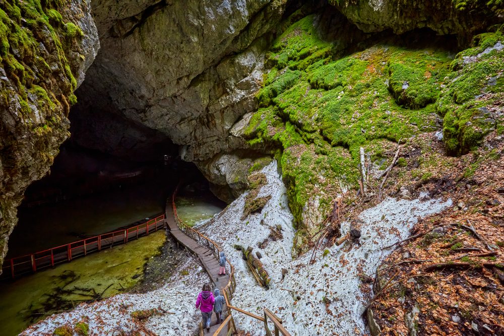
21. Gârda de Sus – Peştera Gheţarul Scărişoara
- Difficulty level: medium
- Distance: 5,71 km
- Walking time: 3 h
- From where to where the route stretches: Comuna Gârda de Sus – Cheile Ordâncușei – Scărișoara Glacier Cave
- Accommodation options: guesthouses or cottages in Gârda de Sus commune
The trail starts from the center of Gârda de Sus, on an asphalted road, and reaches Cheile Ordâncușei. The route continues to the village of Ghețar, then follows the Ethnographic Museum Scărișoara. After 30 minutes on a paved road, you reach the Ghețarul Scărișoara Cave.
Gârda de Sus can be easily reached by following the A3, DN1, DN73A, A1, DN74, DN74A, DN74A, then DN74 again, in the direction of Bucharest – Ploiești – Bușteni – Făgăraș – Avrig – Sebeș – Abrud – Gârda de Sus.
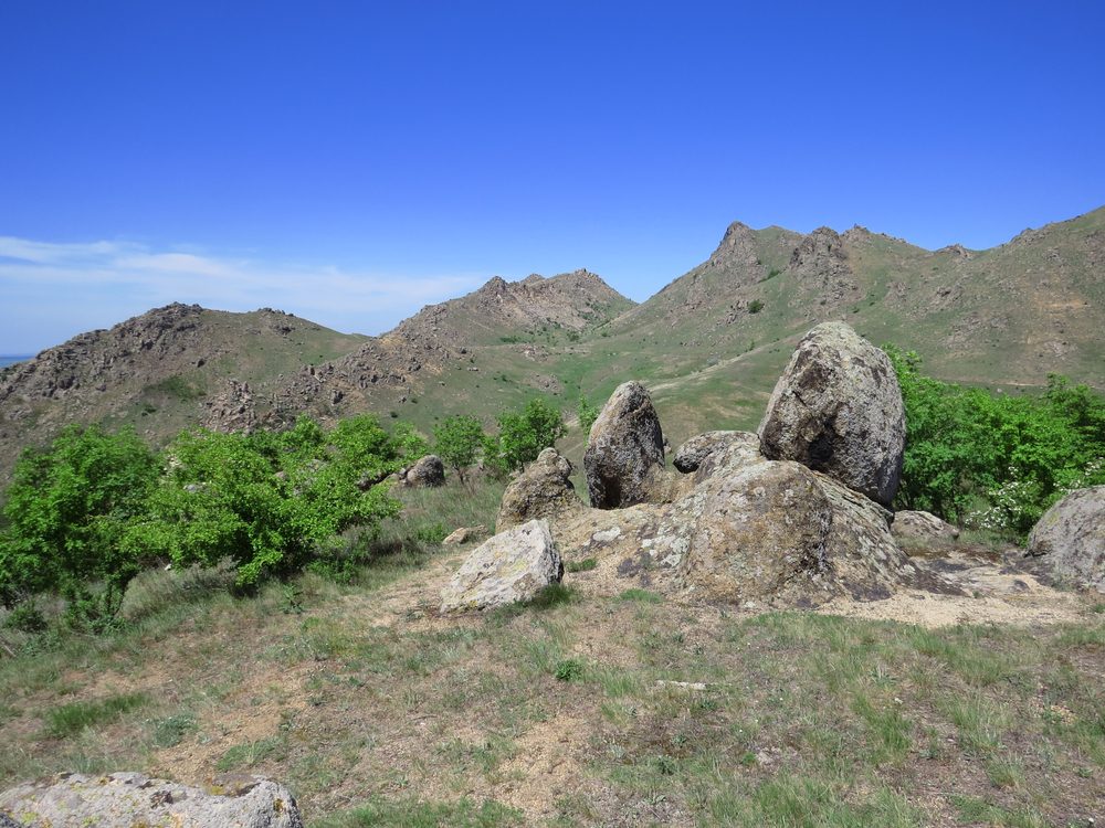
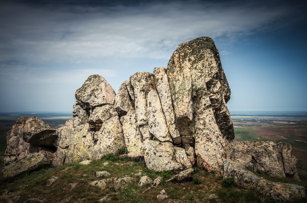
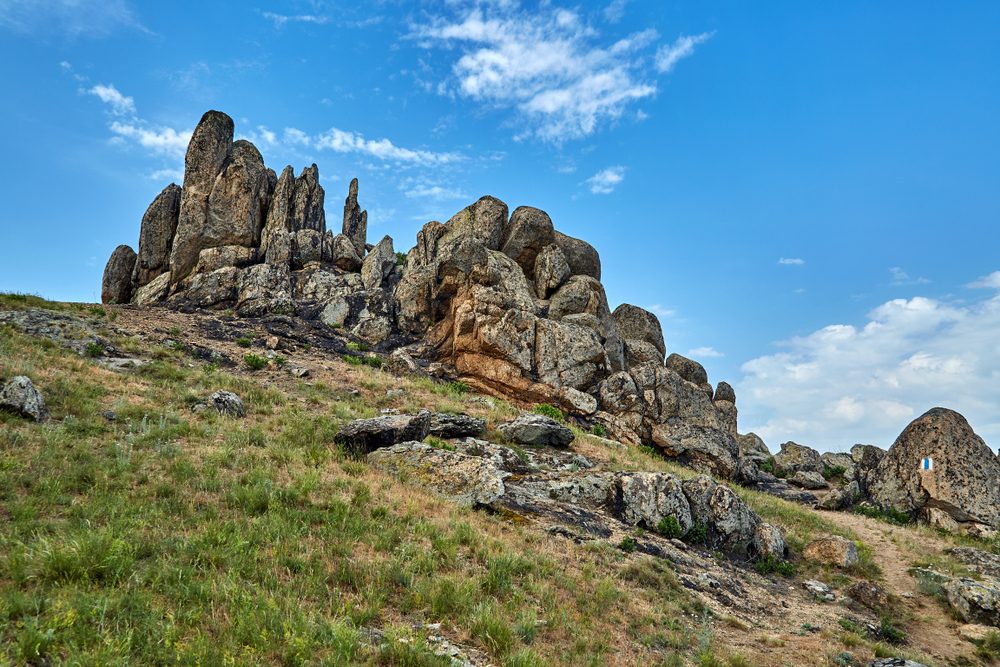
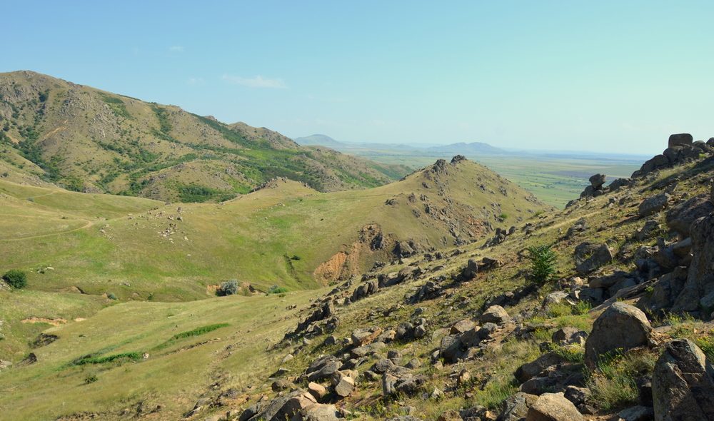
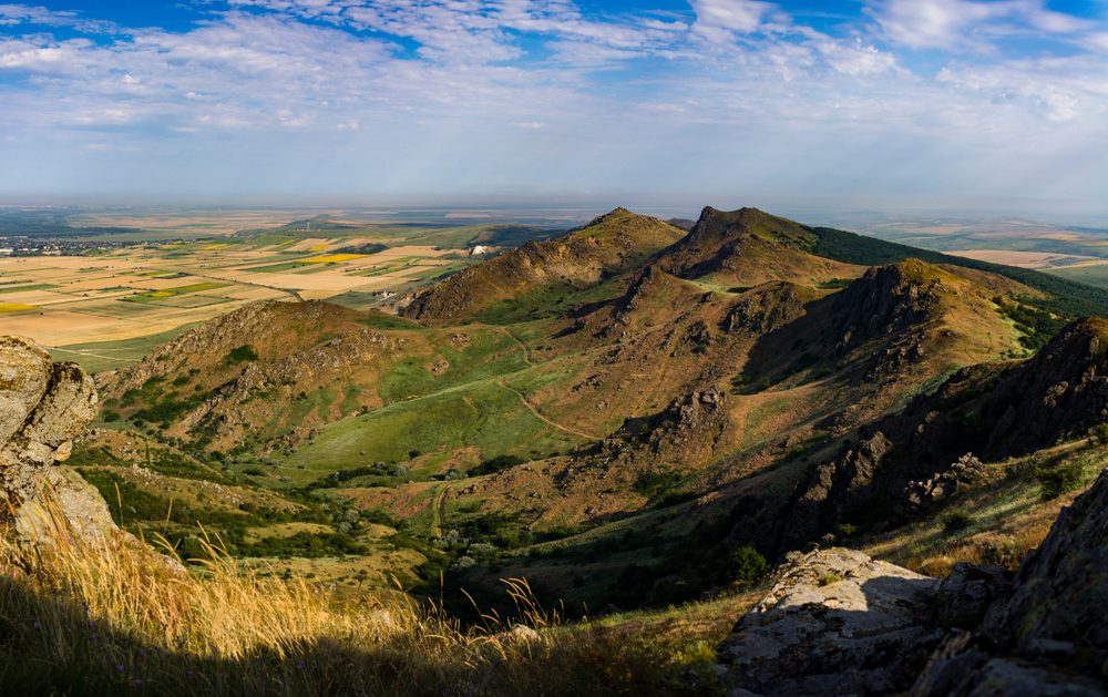
Mountain trails in the Măcin mountains
The Măcin Mountains, ignored in the past for their low altitude, are an attraction in particular for their combination of history, rocky peaks and wild landscapes. Here are a few of the most interesting mountain trails in the Măcin Mountains.
22. Traseul Culmea Pricopanului
- Difficulty level: medium
- Distance: 14,02 km
- Walking time: 5 h 45 min
- From where to where the route stretches from: Măcin – Regia Tutunului – Vf. Suluku Mare – Suluku saddle – Vf. Suluku Mic – Vf. Piatra Râioasă – Vf. Caramalău – Fântâna de Leac – Izvorul Tămăduduirii Monastery – Măcin
- Accommodation options: hostels in Măcin
The route starts from the village of Măcin, in front of the wooden troup, and you will walk about 2 km until you will find the first signpost on the right side. After passing a clearing, you will see a signpost to Teo’s Stones, a group of granite formations. Then continue on through the ash forest and the four peaks (Suluku Mare, Suluku Mic, Piatra Râioasă and Caramalău). After passing the acacia forest, there is a rest stop. The trail continues to the Fountain of Cure, and from here to the Monastery of the Source of Healing and the way to the starting point. Up to the entrance to the National Park, markers are a rarity.
You can drive from Bucharest along the E81, E60, DN22A and then DN22D, in the direction of Bucharest – Dragoș Vodă – Dragalina – Însurăței – Brăila – Măcin.
23. Traseul Poveștile Măcinului
- Difficulty level: medium
- Distance: 7,91 km
- Walking time: 3 h
- From where to where the route stretches: Visitor and Information Center Greci – Racova Valley – Vf. Cartalu – Ditcova Valley – Greci
- Accommodation options: guesthouses in the commune of Greci
Another special route on the mountain trails in Romania is the Măcin Stories Trail. The starting point is the commune of Greci, the Racova Valley Park. From here, the trail climbs up the Dealul cu Drum to Vârful Cartalu. You’ll come across granite rocks as well as animals such as reptiles and small mammals. There’s even a viewpoint overlooking the Danube. In the Moroianu Reserve you can see rare species of flowers. The trail ends with 300,000-year-old rock formations and then returns to Greci.
Greci can be reached by car by following the directions E81 – DN21 – DN2A – DN22A – DJ222F – DN22D or Bucharest – Dragoș Voda – Slobozia – Hârșova – Traian – Greci.
24. Traseul tematic Dealul cu Drum
- Difficulty level: medium
- Distance: 11,42 km
- Walking time: 4 h 15 min
- From where to where the route stretches: Greci Visitor and Information Center – Racova Valley – Red Stone Valley – Curături Valley – Nifon
- Accommodation options: guesthouses in the commune of Greci
The trail starts from the commune of Greci in the Racova Valley. Along the way you will find thematic panels about the history of Dobrogea and Măcin, local legends and plants specific to the area. The trail takes you through several small glades with views of the Cartalu and Călcata peaks. Along the way you may encounter some of the area’s flora, including rock rock rockrose or birds such as the screaming eagle. At Curături Valley there is a rest and camping spot, after which you reach the village of Nifon.
You can reach Greci by car by following the directions E81 – DN21 – DN2A – DN22A – DJ222F – DN22D or Bucharest – Dragoș Vodă – Slobozia – Hârșova – Traian – Greci.
25. Traseul tematic Țuțuianu
- Difficulty level: medium
- Distance: 19,27 km
- Time needed: 7 h
- From where to where the route goes: Greci – Morsu Valley – Vf. Țuțuiatu – Valea Seacă – Valea Fagilor – Information Point Cetățuia – Luncavița
- Accommodation options: guesthouses in Greci
The road starts from the center of the commune of Greci, from where you reach the Țuțuianu street, where you will find the information board of the National Park. You’ll pass through the deciduous forest, then on to the Italian Spring. From here, the route takes you to the Țuțuianu Peak (the highest peak in the Măcin Mountains, 467 meters), then to the Dry Valley and a resting place with a spring. From the top of Țuțuianu you can see the Pricopanului Ridge, the Greci Depression, the arms of the Danube and the Priopcea – Chervant Reservation. After the village of Cetățuia you will reach the village of Luncavița. You can cut down on the long route by using your car for at least one segment of the way.
From Bucharest you can reach Greci by car by following the directions E81 – DN21 – DN2A – DN22A – DJ222F – DN22D, respectively Bucharest – Dragoș Vodă – Slobozia – Hârșova – Traian – Greci.
26. Traseul Valea Vinului
- Difficulty level: medium
- Distance: 13,1 km
- Walking time: 4 h 30 min
- From where to where the route stretches: Cerna – Cerna Valley – Poteca Țigăncii Valley – Vf. Vergu – Vf. Vinului – Creasta Cardonului – Hamcearca
- Accommodation options: hostels in Hamcearca
The Valea Vinului trail starts in the commune of Cerna, and the first part of the trail is shared with the Crapcea trail. You pass the Panait Cerna Memorial House, then cross the stream of the same name. After about 2 km on a dirt road, you will come across an information sign. Walk another 500 meters and you will find a resting place. From the outskirts of the village to the forest you won’t come across any more markers. The trail continues northeast and after 1.5 km you will find a spring. After passing the base of Cardon Peak, Wine Peak and Cardanu, you arrive in Hamcearca commune.
You can reach Cerna from Bucharest quite easily on the road E81-DN21-DN2A-DJ222F, in the direction of Dragoș Vodă – Dragalina – Hârșova – Cerna.
Mountain trails in the Eastern Carpathians
The Eastern Carpathians offer many interesting mountain trails for easy hikes or more demanding climbs. Whether you want peace and relaxation or to push your limits, the mountain trails in the Eastern Carpathians have something for everyone. Here are some great routes in the area.
27. Orașul Bălan – Cabana Singuratică
- Difficulty level: medium
- Distance: 5,20 km
- Walking time: 3 h
- From where to where the route stretches: The town of Bălan – Oltului Valley – Sep Valley – Piatra Singuratică Hut
- Accommodation options: hostels in Bălan or Izvoru Mureșului
On the list of mountain trails in Romania there is also this road that connects the town of Bălan with the Singuratică Chalet. You start the hike on the street called Pârâul Fierarilor, then from the point where the Sep (Szép) stream flows into the river you will follow a forest road. The route then alternates the forest road with ridge areas and gravel road. Before long, the mountain trail meets the ski slope and you reach the Lonesome Stone, behind which is the chalet of the same name. If you wish, you can camp in front of the hut.
You can reach the base of the trail by car. From Bucharest on the A3 highway, then DN1, DN11, DN11, DN12, DJ125 towards the Fierarilor Creek street, on the route Bucharest – Ploiești – Brasov – Sfântu Gheorghe – Miercurea Ciuc – Bălan.
28. Satul Gura Haitii – Dornișoara
- Difficulty level: medium
- Distance: 16.35 km
- Time needed: 8 h
- From where to where the trail goes: Gura Haitii – Vf.Pietrele Roșii – under Vf.Tămău – Valea Voroava – Dornișoara
- Accommodation options: hostels or cabins in Saru Dornei or Vatra Dornei
The mountain trail starts from the village of Gura Haitii, at the fork between a concrete road (on the left) and a forest road (on the right). Follow the trail to the right and after about 1 km you will come across an information board and the 12 Apostles themed trail. Follow the signposts and climb gently through trees and glades. Once you reach the Dorna Valley, turn right and after 1 km you reach the village of Dornișoara. It is not accessible in winter.
You will reach the base of the trail, Gura Haitii, if you take the E85, then the DN2E, DN17, DJ174 and DJ174F, in the direction of Bucharest – Buzău – Focșani – Roman – Gura Humorului – Câmpulung Moldovenesc – Vatra Dornei – Gura Haitii.
29. Izvorul Muntelui – Cabana Dochia
- Difficulty level: medium
- Distance: 5,71 km
- Walking time: 3 h 30 min
- From where to where the route stretches: Izvorul Muntelui Hut – Lutu Roșu Curmătura – Izvorul Alb stream – Stânca Dochiei – Jgheabul cu Hotaru – Dochia Hut
- Accommodation options: hostels in Bicaz, Dodeni or Mărceni
The mountain trail starts from a clearing near the Izvorul Muntelui hut, after which you enter the forest, and next to it you have the stream of the same name. After about 30 minutes, you come to a small rest stop. The road climbs up the Răchitiș Ridge, through beech and resinous forest, then through spruce forest. In the distance you can see Toaca Peak (1,904 m). Walk another 1.2 km until you reach Dochiei Cliff and Sihastrului Foot, where you can also see a small spring. Continuing along the trail you can also see the mountain spring lake. Not recommended in winter on the Stânca Dochiei – Cabana Dochia section.
You reach the base of the trail by following the E85 road, then the DN15, DJ155F and DC21, in the direction of Bucharest – Buzău – Focșani – Adjud – Roznov – Piatra Neamț – Bicaz – Poiana Largului – Toplița – Izvorul Muntelui.
Mountain trails in the Buzăului Mountains
The Buzăului Mountains are marked by diversity. From the granite areas of Șiriu, to the volcanic slopes, the landscapes of the Buzăului Gorges and trails of varying difficulty, the Buzăului Mountains offer an experience for everyone. Here are a few trails worth trying if you make it to the Buzăului Mountains.
30. Barcani – Crucea Toader Bocârnea – intersecţia cu creasta principală (traseul BR)
- Difficulty level: easy
- Distance: 5,8 km
- Walking time: 4 h
- From where to where the route stretches: Barcani – Toader Bocârnea Cross – junction with the main ridge (BR route)
- Accommodation options: hostels in Barcani
This is another mountain trail of reduced difficulty. The hike starts from Barcani, on a road perpendicular to the main road. Turn right at the first intersection and right again at the second. Follow the dirt road that separates the trees from the meadows up to the top of the hill, when you reach a forest road that takes you to the Carpathian ridge. Nearby is a wooden cross and a spring at the base of a tree.
You can reach the base of the trail by following the A3 highway, then DJ100B, DN1D, DJ102C, DN10, then Lazului Street, in the direction of Bucharest – Drăgănești – Urlați – Plavia – Scărișoara – Valea Lupului – Zăbrătău – Barcani.
31. Măgheruş – Vârful Lisnău (Csere) – Satul Lisnău
- Difficulty level: easy
- Distance: 5,7 km
- Walking time: 2 h 30 min
- From where to where the trail leads: Măgheruș – Lisnău Peak (Csere) – Lisnău Village
- Accommodation options: hostels in Măgheruș or Toplița
Start from the village of Măgheruș on the marked road towards Aninoasa. At the second crossroads, go left until the end, then right. Continue along the narrow lane, then climb slightly left, along the pasture. After the portion through the woods, the road continues with pasture and another wood. From the altitude of 770 meters, the descent through the forest begins, then through the glen, until you reach the meadow in the village of Lisnău, where the unmarked downhill road brings you to the village.
You can reach the base of the trail by starting from the A3 and continuing on the DN11, DJ103B, DC27 and DC26B, in the direction of Bucharest – Ploiești – Comarnic – Sinaia – Brasov – Lunca Câlnicului – Ozun – Lisnău – Măgheruș.
32. Crasna – Valea Urlătoarea – Poarta Vânturilor
- Difficulty level: medium
- Distance: 11,4 km
- Walking time: 4 h 45 min
- From where to where the route stretches: Crasna – Vallea Urlătoarea – Poarta Vânturilor
- Accommodation options: guesthouses in Crasna
The mountain trail starts in Crasna, on the road that crosses the bridge over the river Buzău. Follow the road for 5 km along the valley until you reach a concrete bridge (on the left side). Cross the bridge, then come across a spring and an open area, the confluence of several valleys. The road climbs and meanders up, then through some glades, then through the forest. Continue until you reach a rest stop with an information board. After another 700 meters, you reach the Wind Gate.
If you come from Bucharest, you will follow the A3, DJ100B, DN1D, DJ102C and DN10, in the direction of Bucharest – Urlați – Cislău – Nehoiu – Lunca Jariștei – Crasna.
How to prepare for a mountain trail?
Preparing for a mountain trail requires a combination of very good physical condition, mental preparation and the right equipment.
Here are some tips to be physically prepared for a mountain trail in Romania:
- Start increasing your physical activity before the mountain hike. Increase your intensity at the gym at least 6-9 weeks before a mountain trail;
- Increase endurance by running, swimming or cycling;
- Set aside time for weight training – it works to develop leg, chest and arm muscles;
- Go on short hikes close to home and increase the difficulty to build endurance;
- Incorporate yoga exercises into your workouts to improve flexibility and balance.
See below for some recommendations related to mental preparation for a vacation trail in mountainous Romania:
- Do your research – learn as much as you can about the route you want to do, how difficult it is, where you can park your car, what the weather conditions will be;
- Set realistic goals – objectively assess your physical condition and choose a route that suits you and your family’s abilities (if you’re walking with children);
- Prepare for emergencies – you’ll save yourself a lot of stress if you prepare in advance for an emergency. Take a first-aid kit with you and write down the telephone number of the mountain rescue service.
Equipment is very important in the mountains. Here’s what you shouldn’t be without if you venture out on the trails in Romania:
- Mountaineering/hiking boots – choose sturdy, waterproof, supportive footwear. Wear them for a few days before hitting the trail;
- Backpack – choose a backpack that is comfortable and big enough to put the things you need for a 5-7 hour hike;
- Clothing made of breathable and water-resistant materials. Dress in layers and adapt your outfit to the weather conditions;
- Map, compass or GPS device – find out how to use them before the hike. Ideally, you should also have a map of the mountain routes you are traveling;
- First aid kit – so you can treat superficial wounds;
- Sunscreen;
- Food and water;
- Head torch – essential for the unexpected when you get lost or if you’re hiking early in the morning.
What to know about mountain markers?
Whether you want to see Romania’s highest peak up close or just want to test your fitness, it’s a good idea to be familiar with the mountain markers. If it’s your first time in the mountains or your first time on the route, it’s a good idea to follow the markings to reach the peak safely and avoid dangerous areas. Here are the main mountain markers and what each one means:
- Red, yellow or blue bands – these are main or ridge trails;
- Red, yellow or blue crosses – these are connecting routes;
- Red or blue triangles – these are secondary routes or roads to a mountain peak;
- Red, yellow or blue circles enclosed in a square – show a circuit trail;
- Blue circles (without square) – indicate a round-trip route;
- Red square in a white square – indicates a protected natural area.
Why is so special Enterprise Rent-A-Car?
Renting a car to get to your desired mountain trail(s) can be a great choice, whether your own car is in for a service, you’re traveling for work and have a few days off in the mountains, or you simply want a car you can rely on. Here are a few reasons why Enterprise Rent-A-Car is a reliable partner:
- Every customer is supported and appreciated. Employees listen to customer wishes and adapt to ensure the highest quality service;
- At the center is honesty, integrity and respect;
- Enterprise Rent-A-Car helps strengthen communities;
- Building a long-term relationship by meeting transportation needs and earning trust.
Romania’s mountain trails are a special attraction for any hiking enthusiast. From peaks over 2,500 meters, to trails with views of glacial lakes and the unique-looking Măcin Mountains, each step offers a natural spectacle and tests your physical and mental endurance. Equip yourself properly and get ready for the journey. The adventure is just beginning!
Source: Shutterstock 1, Shutterstock 2, Shutterstock 3, Shutterstock 4, Shutterstock 5, Shutterstock 6, Shutterstock 7, Shutterstock 8, Shutterstock 9, Shutterstock 10, Shutterstock 11, Shutterstock 12, Shutterstock 13, Shutterstock 14, Shutterstock 15, Shutterstock 16, Shutterstock 17, Shutterstock 18, Shutterstock 19, Shutterstock 20, Shutterstock 21, Shutterstock 22, Shutterstock 23, Shutterstock 24, Shutterstock 25, Shutterstock 26, Shutterstock 27, Shutterstock 28, Shutterstock 29, Shutterstock 30, Shutterstock 31, Shutterstock 32, Shutterstock 33.